


Chris Maylor, who runs a Saddleworth Discovery Walks blog, brings you a walk along the Castleshaw Skyline.
For more information about local walks, email Chris at saddleworthdiscoverywalks@gmail.com or visit his Facebook page.
Start/Finish: Lay-by on A62, Huddersfield Road, Delph
Grid Reference: SD 992 081.
Distance: 7 miles
This walk, around the rim of the Castleshaw Valley, was conducted last year as the winter snow began to recede.
From the lay-by, we carefully crossed the busy A62 to the wooden stile almost opposite. Climbing the stile, we made our way south-east along the footpath which ascends Lark Hill to attain Harrop Edge.
Turning north along Harrop Edge Lane, we were confronted by a cold wind blowing in from the East. It was this that had brought in the recent bout of snow which, although now receding as the spring temperatures began to rise, was lying in deep drifts on the frozen ground.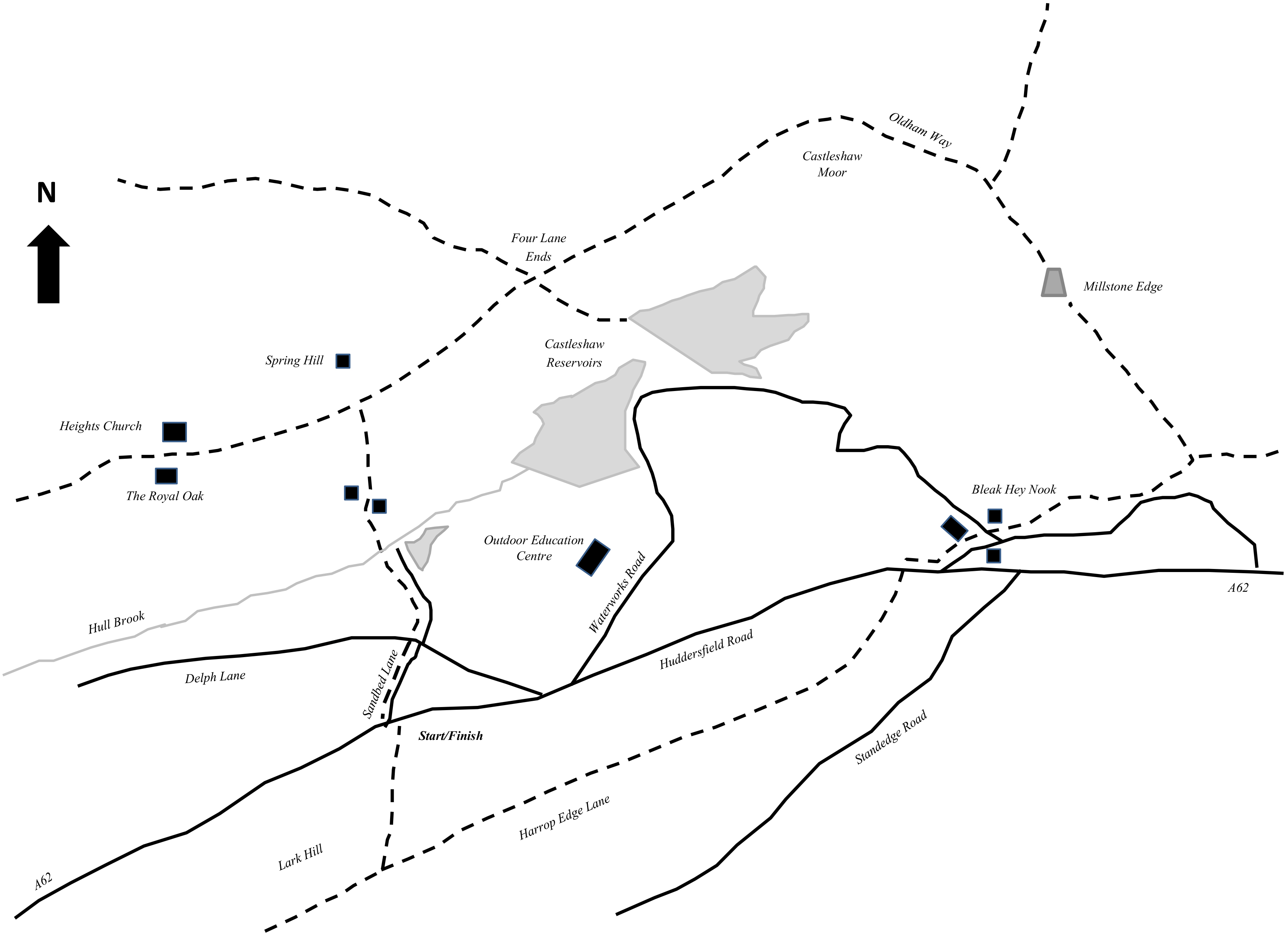
Crossing the A62 onto Standedge Foot Lane, we passed behind the old, derelictHorse and Jockey pub before heading up a grassy track that is Whimberry Lee Lane.
At Standedge, we ascended pure white, crisp snow fields to attain the trig point on Millstone Edge. Under a clear sky, there was not but a breath of wind on this rocky edge which marks the Lancashire/Yorkshire border.
The views all around were magnificent and far reaching, and we marvelled at the wonderful vistas. Although today was glorious, this rocky edge is often battered by strong winds the year round.
In bad winter weather this must have been a grim posting for the Roman soldiers stationed at the fort in the valley below to guard the military road from Chester to York.
One of a series of Roman Forts the original stronghold covered over three acres and garrisoned around 500 infantry. At some point it was abandoned, until being re-occupied in the early second century A.D. as a small out-post.
Following the Oldham Way, we made good progress over the firm snow. Looking over to the West, Denshaw reservoirs could be seen glistening in the sunlight.
Picking up the Pennine Bridleway, we dropped down Moor Lane where it meets Ox Hey Lane at the old Cross Roads known as Four Lane Ends. Continuing south, we enjoyed traversing the deep snow drifts that completely filled Broad Lane. The views down into the Castleshaw Valley were a delight as we headed towards Heights.
Opposite the entrance to Spring Hill we turned south-east, towards Grange, and descended the sunken bridleway, which is believed to have been an old packhorse road or ‘saltway’.
This area of Saddleworth was part of Friarmere which in turn was part of the Roche Abbey estate. Local historians believe the Black Friars had a house or ‘Grange’ here which possibly lends its name to the area.
Our descent once again took us over deep snow drifts and we eventually emerged at the ford which crosses Hull Brook. With our outing nearing the end, we followed Hull Mill Lane, crossed Delph Lane and walked the final few metres along Sandbed Lane to return to the lay-by on Huddersfield Road.
You must be logged in to post a comment.